 Looking back at the History of England's capital from before the Romans arrived right up to the present day.
London 2000 Years Ago
Before the Romans arrived some 2000 years ago there is no evidence of London existing as any sort of thriving town or village. When the Romans arrived they quickly chose the London area as the HQ for all activities in their new island colony perhaps because the area between present day Cannon Street Station and the Tower of London, on the north bank of the River Thames made an ideal port and with quick access to high ground. An ideal place to make a settlement. In addition, at this point two smaller rivers join the Thames from the north providing easy access to extra clean drinking water and additional defence from attackers.
These two rivers are now no longer to be seen but can easily be located.
The first is The Walbrook. The mouth of the Walbrook is now under Cannon Street railway station and it's passage from the north follows Walbrook Street which connects Cannon Street station with the Mansion House and the Bank of England almost due north.
The original Roman settlement stretched from The Walbrook river (Cannon Street Station) in the west to the Tower of London (which did not exist) in the east.
The second river is the Fleet just over a quarter of a mile west of the Walbrook which is a much larger river and flows north south under present day Ludgate circus and Farringdon street. Roman London eventually stretched from the Tower (built 1000 years later) in the east to the Fleet River in the west. London Wall was the northern boundary and over a bridge (on the site of present day London Bridge) to present day Southwark described the city limits in the south . Hence the area north of the Thames was approximately ½ mile north south and just over a mile east west.
Walking west from present day St Paul's Cathedral the road drops away steeply to Ludgate Circus and it is easy to imagine a large river infront of you before the bank rises steeply on the other side to a road now called Fleet street. Indeed the river is still flowing but in a tunnel under the street
After only a few years of Roman occupation, when the town had no protective walls a local British Queen "Boudicca", from East Anglia, burnt the place to the ground!
After Boudicca, over the next 200 years the Romans built "Londinium" into a fortified city of considerable wealth and comfort covering an area of some 330 acres surrounded by a wall 20 feet high.
It is possible today to "take a walk" round where the wall was, locating its position via its famous gates which names are still in existence today. Starting in the west at present day Blackfriars Bridge walk north only about 200 yards to "Ludgate" (now Ludgate circus). Continue north up Farringdon road and stop under Holborn Viaduct which used to be the junction with Newgate Street. Turn right up Snow Hill to Newgate St and at St Bartholomew's hospital you are now at the position of Aldersgate Make your way to London Wall (Street) and walk east, close to Moorgate tube station then Bishopsgate (street) towards Houdsditch (street) and cross Aldgate High Street and south towards the Tower of London down The Minories (street).
That's a quick trip round Roman London.
Many of the Roman London houses and the city wall were built of "Ragstone" which was quarried about 30 miles to the east of London at Maidstone in Kent. An easy passage by ship down the river Medway and up the Thames.
The Romans used London to bring in all their vital goods from the rest of their empire particularly of course military equipment. Also of course the comforts they were used to including: Olive oil, wine, dates, figs and salted fish. The containers would have been the typical earthenware jars of the day called Amphorae. They also imported bronze ornaments, pottery, glass and millstones. London would have had all the trappings of Rome at that time.
London 1500 Years Ago
When the Romans left (to defend Rome against the German Vandal tribe) the German Saxons moved in. Being basically rural peoples they had no use for towns and London was abandoned. The Saxons chose Winchester just north of present day Southampton as their base. It was not until some 200 years after the departure of the Romans (about AD 670) that the London area was reoccupied (by the Saxons) to any effective level and it was in a new area around present day Charing Cross and Trafalgar Square that was to be their base for their new city and port. The old Roman city must not have been worth inhabiting for rural peoples? For those who know London this area would obviously have made a good port with immediate access to high dry ground. (Note the present day embankment did not exist.) The only building of note in the old Roman area which was used by the Saxons was the site of St Paul's for a church of that name. There was also a Saxon Palace (position not known). International trade through this port would have been mainly sheep's wool and woollen clothes for which Britain was famous. Silver coins were also minted in London (then called Lundenwic by the Saxon inhabitants).
This little cosy scene was catastrophically changed with the arrival of 350 Danish Viking ships in the Thames in about AD 842. And in AD 865 a massive Danish Viking army assembled in East Anglia, destroyed Saxon rule in the East and North of England and made London their winter HQ.
Saxon King Alfred, with headquarters in Winchester, was the only Anglo Saxon ruler to survive. He decided enough was enough and retook London. In 886 he finally made some use of the old (400 years old) Roman defences and remade London between Blackfriars and the Tower as a fortified town.
The next 100 years saw many changes in London which stood at the hub of the three divisions of England. Saxon southern England or Wessex, all areas south of a line through the current M4 and including Kent but excluding Cornwall which remained unconquered and Celtish. North of the M4 was Mercia which stretched up to the present A5 road and was occupied by Angles (West Anglia). The remainder of eastern and northern England was ruled by the Danish Vikings. That is commencing in London, east of the river Lea and Lea Marshes and running north south through present day Wathamstow. Indeed all of England north and east of the A5. This was a relatively stable division as the Saxon rulers in London persuaded the Danish Vikings to stay in their allocated territory in return for a regular monthly income of silver pennies minted in London. This was much the same arrangement as the French had with the Vikings who were bribed to settle only in Normandy.
Saxon Kings remained in charge of London with the notable exception of Danish King Canute and then his son. Canute ruled simultaneously in Scandinavia. The next Saxon king to follow Canute was Edward the Confessor a religious man who changed the face of London. He rebuilt the old Roman London Bridge and started a development of London in a totally new area west of the Roman/Saxon town, on an island on the marshy banks of the river Tyburn (now Westminster then West Minster) with a new church dedicated to St Paul. Edward also built himself a new palace alongside which eventually became the Palace of Westminster or as it is now better known as the Houses of Parliament.
Edward was buried at Westminster in January 1066. In the same year, King Harold a Saxon King and the first Norman King, William the Conqueror were both crowned at Westminster.
London 1000 Years Ago
When William the Conqueror arrived in 1066 he made London his HQ and following his Norman strategy built up a nation-wide system of defensive castles. The most famous one in London being the Tower of London built at the place were the old Roman city wall joined the Thames at it's eastern limits. The original Castle, now almost 1000 years old, was called the White Tower and can still be visited within the walls of the Tower of London. The Tower of London remained a home for the kings from 1087(William 2nd ) to 1500 (Henry 7th ).
During this period and until the end of the middle ages, that is for the next 500 years London remained much the same as follows.
- The main city area remained within the original Roman city walls.
- A new area to the west at Westminster was established as the headquarters for the King and all the trappings for running the country plus the magnificent Westminster Abbey. Government offices like the Treasury were slowly moved from Saxon Winchester to Westminster. The City of London and The City of Westminster were connected by both road and river. The latter was the fastest route and other than for processions the river was always used by the Kings. The road route can still be followed today. West to East: Whitehall, Trafalgar Square, turn right The Strand, Fleet Street then through Ludgate (now circus.)
- The area of Southwark is in exactly the same place now as in Roman times.
- London Bridge was the only connection between the walled City and Southwark and the important roads south, notably to Winchester and Dover for France.
Two building projects early in this period are worth noting.
- Lambeth Palace was built as the London home for the Archbishop of Canterbury. Lambeth then as now is almost directly across the river from Westminster Abbey. 1000 years ago both areas were surrounded by marshes so the best route from one to the other would be to take the short ferry boat trip across the river.
- London Bridge was rebuilt in stone in 1172. Up to this time the bridge was made of wood. This new bridge with 19 arches was completed 33 years later. The driving force behind the new bridge and indeed of many other bridges was the church who spread the message that bridges should be financed with free gifts from the public (alms). This stone bridge lasted 600 years. Gifts, rents and taxes collected by the church became significant and this same trust recently also funded Blackfriars and Tower Bridge and purchased Southwark bridge. Early income sources included; tolls on carts using the bridge, tolls from ships passing under the bridge and fines from illegal fishing from the bridge.
It is also worth noting the vast number of churches that were built in London at this time. (Over 100 by 1200 AD)
Population. Maximum 80,000 people between 500 and 1000 years ago falling to perhaps 40,000 during the times of the plague. The bulk of Londoners lived within the old (Roman) city walls.
London 500 Years Ago
There were no major changes to the layout or skyline of London since the time of the Norman Kings onwards with the notable exception of St Paul's Cathedral built in Gothic style around AD 1200 with an outstanding spire . (On the site of the earlier Saxon Church.) The magnificent spire was unfortunately struck by lightning in 1561 and was dismantled for safety. (Note this magnificent church was destroyed in the Great fire of London in 1666 and replaced by the present smaller domed structure designed by Christopher Wren.)
London was still basically contained within the old Roman city walls, with one bridge over the Thames south to Southwark and access west to the growing but separate town of Westminster. By about 1300 the road from the City of London to City of Westminster along Fleet street had properties on both sides of the road. Also a little to the south, the law courts of the Middle Temple (best now seen from the Embankment) and to the north Lincoln's Inn both dating from 1310. Other than this the land within a few hundred yards of the city walls was still green fields and cultivated to provide food for Londoners.
NOTE - The Inns of Court were formed in England in 1310 at the time of Edward the 2nd who in general had an appalling record in office! Called "Inns" because as Oxford and Cambridge Universities did not teach law, students needed a place to stay and study. Where better than in rooms close to the law courts. These Inns, now some of the oldest buildings in London as they were not in the path of the Great Fire are:
- Lincoln's Inn close by the junction of High Holborn and Chancery Lane.
- Middle Temple and Inner Temple on the river side "Embankment" between Waterloo Bridge and Blackfriars Bridge.
- Grey's Inn, north of Chancery Lane Tube station between High Holborn and Theobald's Road
The administrators had the exclusive right appoint Barristers who had, and still have, exclusive rights of representing clients in the higher courts of England. Today these wealthy Barristers occupy the original 700 year old Inns which because of their age and historical position are not allowed to include such modern comforts as central heating! And one is surprised to see rich men huddled over an old electric fire to keep away the winter chills.]
500 years ago Henry the 8th saw to many improvements. Initially he was a builder of fine Palaces (for himself) perhaps he needed some of them as both his Westminster Palace and his City Palace in the Tower of London suffered fire damage. He built:
Bridewell Palace just outside the city walls on the west bank of the river Fleet and the banks of the Thames and Baynard's Castle (actually built by Henry 7th) just inside the city walls also on the banks of the Thames. The position of this castle is marked today by the street called "Castle Baynard Street" to the east of the Mermaid theatre.
Henry also distributed the many fine London properties previously owned by the Church at the time of the Dissolution. This had a considerable impact because probably some 60% of the properties in London were owned by the church and releasing these onto the property market eliminated any over crowding in London and of course filled up the financial coffers managed by King Henry 8th himself.
Also around this time many of the old gates in the original 1000 year old Roman city wall were rebuilt notably Ludgate, Aldgate and Aldersgate. The buildings attached to the city gates tended to be used as prisons as was customary across all Europe.
Economic growth and the expansion of London
London was the largest trading centre in England with trade at that time being dominated by the sale of fine English wool (from Sheep) to Antwerp mainly where it was woven into cloth. Clothes were also made locally in Antwerp.
Then London was able to attract much of the manufacture of this cloth back into London because of the wars around Antwerp, (now in present day Belgium but then part of the Netherlands, which was split north/south through Antwerp between the Protestant north and the Spanish Roman Catholic south). This created a huge demand for labour and housing in London which was satisfied by the occupation of the previously religious buildings "acquired" by Henry 8th . This was coupled with a movement west into the Fleet street area by the wealthier peoples into the new green field areas. These included many wealthy traders who had fled from Antwerp to run their businesses from London.
Up to this time the population of London had not changed materially since Norman times at around 80,000 to a low of 40,000 at the time of the bubonic plague. In the next 100 years the population tripled to 250,000. Where did they all go? Expansion was as follows:
- Westwards to Westminster both along the river bank and Fleet Street and the Strand.
- An Expansion in the Westminster Area. Also expansion along present day High Holborn.
All these areas were inhabited by civil servants, the wealthy merchant classes and the growing educated elite like lawyers and doctors. North of the city expansion was limited to ribbon developments up the present day A1/ Aldersgate Street as far as present day Old Street and the medical college of St Bartholomew's hospital. There was also ribbon development to the north up Bishopsgate Street. Between these two ribbon developments, directly north of Moorgate, were still the green fields of the now drained swamps of Moorfields where Londoners used to skate in the winter.
To the east there was considerable ribbon development along the north bank of the Thames to service the new Docks of Wapping and Ratcliffe( see present day northern entrance of Rotherhithe Tunnel and on the river front, Ratcliffe Cross Stairs and Limehouse Basin). To the south the main developments centred round Southwark which, as in east London, housed the "working classes". The area around Lambeth Palace was still undrained marsh land.
It was in the south east of London that Henry 8th was born in the royal palace of Greenwich and he was brought up in a palace in Eltham until he was 15. Both these palaces, then surrounded by green fields can be visited today. While in this area it is worth taking the trip from Greenwich, south to the old Dover road across Blackheath, originally built by the Romans and as they normally did, using hills as landmarks to ensure the road was straight. There is probably not a better example of this than Shooters Hill on the old A2 just east of Blackheath where the Roman road makers took the old Dover road right up to the top of Shooters Hill and down again. The result on horse drawn coaches is well described in the first chapter of the Tail of Two Cities-the passengers had to get out and push. Eltham lies just south of this road and north of the A20.
London 250 Years Ago
We must start this period some 100 years earlier in 1660 that is just before the Great Fire of London. The population of London had increased from 80,000 in 1500 to 250,000 in 1600 and 375,000 in 1650.
During the short period when England was a republic under Oliver Cromwell London was continuously under threat from the pro-Royalists so Cromwell built a new defensive city wall which conveniently defines the limits of London at that time.
Starting on the Thames well to the west of Westminster Abbey at present day Vauxhall Bridge the wall went north east to Hyde Park Corner. Then turning north west to present day New Oxford street and further North and east along present day Pentonville and City roads. Then in a southerly circular route along Great Eastern Street, Commercial street and south to the Thames at Wapping. The south side of the river had a city wall for the first time starting in the east, south of Wapping close to the southern entrance to present day Rotherhithe Tunnel along to an east west wall running from the Old Kent Road (Old Dover Road) to the Elephant and Castle to the Imperial War Museum then South West to Vauxhall Bridge. In all eleven miles.
This wall was never attacked and was demolished in 1647 such that today almost nothing remains.
In 1665 London was hit by another massive bout of Bubonic Plague which mainly hit the poor areas outside the old Roman city walls. (Although all areas were affected to some extent)
The Great Fire of London 1666
On Sunday the 2nd September 1666 a fire started just a few yards north of London Bridge in a bakery in Pudding Lane. The spot is marked by "The Monument" to this day. The summer of 1666 was particularly hot and dry, there was a strong wind from the east (the usual wind direction in the south east of England with high pressure in the North Sea) and London dwellings were made of wood. Even worse the fire spread along the river bank to the west through the small docks crammed with pitched and oiled timbers. On the first day, an area from Billingsgate docks to Queenshithe was burnt to the ground. On the second day, 50% of the area within the old Roman walls was effected including St Paul's Cathedral. On the third day most of the area west of the Tower within the city walls was destroyed. On this day the fire also jumped the river Fleet (Ludgate Circus) and demolished everything east of Fleet Lane. (Leaving the Inner and Middle Temple intact) At this point the wind dropped.
In all some 13,000 houses were destroyed together with 87 churches and 52 company halls. (Mainly beautiful religious buildings taken from the church by Henry 8th )
This was more than three times the damage done to the City of London than during the second world War by the German Luftwaffe. Charles 2nd was the King at this time and was resident at Westminster. He put his son the Duke of York (afterwards King James 2nd ) in charge.
The rebuilding programme.
After three years work and without state finance, London was habitable again with 9000 new houses built and some of the very narrow streets widened. Replacement public buildings were financed from a new tax on coal. The rebuilding of St Paul's was not completed for 14 years when London was cleaner and safer with buildings not made from wood, which was banned, but fine brick and stone. The two architects who had submitted grand plans for relaying out London within a grid pattern (Christopher Wren and John Evelyn) obviously did not get their way. Their plans were too expensive.
100 years on 1750 (250 years ago)
At the time of Henry 8th , say 500 years ago, London was smaller than Paris, Venice and Naples. By 1750 London had outgrown all of them (population then about 750,000) even though the population of France was more than double that of England. This population growth had been achieved without the niceties of clean water, clean food, good clean roads or any main sewage disposal system. As a result TB and Cholera were endemic and life expectancy amongst the poor was short.
This was the period illustrated by a well known artists of the day showing a mother and baby both drunk out side a pub on cheap gin. London was now becoming divided geographically into areas for the rich, the new middle classes and the poor. Those rich, who needed to move, chose the new areas of Mayfair and Marylebone that is in the area now best described as north of Piccadilly and south of Regents Park. This area is still one of the most sort after parts of London. The new middle classes chose to leave the centre of London for the new suburbs. Initially Blackheath, Twickenham and Islington then Dulwich, Putney and Richmond. It is interesting to note that other than Islington all the other new "villages" at were on the virginal rural sites in a new South London.
This demanded a massive Thames bridge building programme. We have from east to west:
- Blackfriars 1769 (by the Fleet river)
- Westminster 1750 (First alternative to a ferry crossing between the area of the Kings at Westminster and the church HQ at Lambeth.)
- Battersea 1772
- Putney 1729 (new suburbia)
- Kew 1759
- Richmond 1777 (new suburbia)
The poor people built new shacks in the outlying areas of:
Rotherhithe, Blackwall, Deptford, Greenwich, Poplar, Wapping, Limehouse, Seven Dials, Bethnal Green, Petticoat Lane and Southwark.
Poor people were getting poorer and some 120,000 poor Londoners took to crime to eke out a living, notably prostitution and pickpocketing.
There was no police force and no street lighting. (Gas street lighting came in in 1738)
London 200 Years Ago
This was very much a time of contrasts with London as the commercial centre of the industrial revolution creating more pollution from more people burning coal arriving by sea from Newcastle and more factories creating poisonous by-products.
This was also Regency London with the King spending a fortune in an attempt to create London as one of the best cities in Europe. Obvious results are Regents Park and the road to it from the King's Palace, Regent Street. London also got its first by-pass road across its northern limits which are the roads now called Euston Road and City Road. Much of the land north of these roads were still green fields 200 years ago. Because of the huge increase of national and international trade into London at this time due to the industrial revolution and the trade developed by the expanding colonies plus USA, there were two obvious changes to London to note;
- The huge expansion of the Docks down stream from London and
- The Turnpike (toll roads) into London.
The Docks
Going down stream (east) from the "Tower" the closest development (1807) was Surrey Docks on the South Bank (Now a well laid out housing and industrial development). Further down stream across the neck of the Isle of Dogs, West India Dock was built in 1802. East India Docks built (1805) (Found across the river from the 2000 Millennium Dome. In all a huge 5 miles of river dockland development.
Main turnpike toll roads into London
Many of these roads still followed the old Roman trunk roads built some 1700 years previously. The Romans had a habit of building roads from a point to another visible point in a straight line and hills were a convenient land mark and vantage point to enable the road to be built straight. Three hills used for this purpose in the London area were Highgate, Hampstead and Shooters hills. This was fine for getting the road straight but caused the poor horses a problem getting the heavily laden stage coaches up the steep inclines. (As noted in "The Tail of Two Cities" where the passengers had to get out and help push the coach up Shooters Hill)
The road north via Hampstead Heath was in green fields after "Tottenham Court Gate".
The road to Highgate was in green fields after "Islington Gate"
and
The Dover Road via Blackheath and "Shooters Hill" was in green fields after Southwark.
In addition to this A1, A4, A3 and A10 routes were established but not named by these numbers.
There were also main roads to Hythe, Rye, Newhaven (all ports) and Arundel at this time.
London 150 Years Ago
Population
This was Victorian London, the capital city of England and the seat of the largest empire in the world. For most of this period London was still filthy, Cholera and TB were endemic, life expectancy only some 20 years and crime was out of control. Population growth was partly to blame (1million to 7million in the 100 years to 1900) but so was the indifferent attitude of the rich to the poor. This included the Queen (Victoria) and the government. The well off never visited the poor areas. In about 1800 the rich, middle classes and the poor lived within a few minutes walk of each other where the poor could walk to work to serve the rich as carpenters, drapers, shoemakers etc and they would all visit the same church (there were hundreds of little parishes in London). By 1850 or 150 years ago the population had grown to 3 million, the rich and middle classes were moving out of the centre to the "best new streets" "never again" to visit the areas occupied by the poor. It was then considered too dangerous!
Geographical expansion.
A quick look at a map of the time compared to say 1750 and the change would be obvious. Together with a general expansion outwards the big change was the populating of South London for the first time. Southwark had been inhabited since Roman times being directly accessed by the only bridge across the Thames for 1700 years (London Bridge). Much of the land round Southwark was marshy and not suitable for building until properly drained (around 1800.)
Bridges
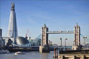
Six new bridges had been built in the previous century but only two, Blackfriars and Westminster served central London. After 1800 Londoners got four more to service the centre and particularly the newly built up areas south of the river. ( Southwark Bridge 1819, Lambeth Bridge 1862, Vauxhall Bridge 1816 and Tower Bridge 1894.)
Also tunnels at Deptford/Surrey Docks (Rotherhithe) and Greenwich (Blackwall).
Transport
This was the age of the train which conveniently transported the rich into the new developing suburbs. Rich Inner Londoners would travel by Handsome Cab (Horse drawn for up to four persons) and the not so rich would use the horse drawn Omnibuses. Two decker two horse "buses" carrying some 20 to 30 people.
(The idea and the name was pinched from Paris as a means of transport for everybody. Unfortunately still too expensive for the poor. The various competing operators quite soon went bust and were then taken over and successfully run by a French company!)
The first suburban train service(1836) went from the south side of London Bridge to Greenwich and still runs today. The first 4 miles east from London Bridge was elevated on a brick viaduct which still stands! At first the railways were not allowed to enter the centre of London which was to change in 1866 and caused the displacement of 76,000 people. (There was no re housing policy for these poor people which caused the over crowding of the slums to get even worse as friends took them in.) The famous London stations of Liverpool Street, Charing Cross, Paddington and St Pancras date from this time. By 1875 the rich and middle classes could commute by train to the following still well known middle class areas:
Blackheath and Bexley Heath, Bromley and Chislehurst, Sutton and Surbiton, Richmond and Twickenham, Harrow and Pinner, Finchley and Barnet and Chingford and Loughton. And further afield.
Inner London and suburban transport was soon to be augmented by the Tubes, (Metro) initially the "Tuppeny Tube" which is now part of the central line. New Cross, Wimbledon and Clapham in the south and Hounslow and Harrow in the west could all be reached by "tube" by 1900. Inner London and the most of the well known suburbs could also be reached by horse drawn tram (Running on rails in the street) Notably Catford, Dulwich, Tooting, Hampstead, Highgate and Woodgreen.
The two major road developments of the period were: the building of the Holborn Viaduct (1869) designed to speed up the horse drawn traffic east west between the City and the West End as the poor horses struggled up and down the fleet river valley at Ludgate. Plus the Victoria Embankment(1870) which "reclaimed" some 37 acres of land from the Thames from the Houses of Parliament north and west to Blackfriars Bridge by building a new river wall 500 feet out into the Thames. This extra land was mainly used to create a grand new riverside road and underneath, part of the Tube. Below the Strand new gardens were created which are still there for busy Londoners to enjoy.
Other road improvements included; The creation of Trafalgar Square and Nelson's Column, Piccadilly Circus and the North Circular road. Slum clearance allowed the creation of Kingsway and the Aldwich. (No re-housing schemes of course!)
Housing, Health and Sanitation
Drinking water
"The Great Stink" of 1858 sums up the situation. All sewers from the old north side of the Thames flowed directly into the river mainly by open surface drains. The inhabitants of the newly populated south were served with drinking water pumped from the Thames, extracted directly adjacent to the outflows of these sewers. Life expectancy was short! Those living in the north were better off, as much of their water was supplied by a new river diverted for the purpose. The problem was eventually relieved by building "intercepting" sewers in the north and pumping the sewerage into the Thames further down stream at Beckton and Crossness (Not in my back Yard!)
Housing for the poor and the rich
The rich and middle classes were able to look after themselves but the poor 1/3 who were all living below the poverty line had nobody to turn to for help. The area of North Kensington (close-by the current Kensington Hilton and Shepherds Bush) was populated by households who made a living out of a few pigs, part time building labouring and other seasonal work. Housing which they built themselves was not much better than hovels from the dark ages and this was Victorian England. Similar areas were Hoxton, Whitechapel, Wapping, Bermondsey and Southwark.
Meanwhile the rich were living in Victorian splendour in Mayfair, Wimpole Street and out in the new suburbs. Clapham was a good example were new posh housing estates were developed with large detached houses in secluded gardens.
A new building phenomena developed that of the spec builder i.e. building houses, flats and office blocks before occupants had been identified. In Notting Hill the spec builders caught a cold, building too many posh terraced houses for the upper middle classes. To sell them they had to be subdivided and sold to the lower middle classes.
The idea of flats (apartments) was copied from the French and anybody who lived in a flat was naturally assumed to live like the French and have a mistress! Office blocks for multi ownership were also constructed.
Finally help was at hand for the poor, not from the government but from rich benefactors. Two good examples, the Rothschild family who naturally enough built subsidised flats for poor Jewish families, and an American Mr Peabody, living in London at the time, who did much the same thing. Many flats built by Peabody can still be seen today and are currently being renovated.
Shops
This was the start of the great London department stores. All these names are still in business; Maples and Heals in Tottenham Court Rd were adjacent at the time to the furniture makers in London. Sainsbury, originally a butcher, Marks and Spencer (actually started in the north of England.) W.H. Smith and William Whitely. The latter has just totally renovated its store in Bayswater. Plus of course the most famous and still perhaps the most useful, Harrods in Knightsbridge and Selfridges in Oxford Street. All department stores were originally designed to service women who by 1860 could conveniently visit the London shopping areas by train for a days shopping to furnish their new "mansions" in the suburbs.
Law and order
The rich described the poor as "decadent and set for self destruction". 30% of the population of London were described as below the poverty line. A picture so well painted by the contemporary writer Charles Dickens, many of whose characters he took from real life including his own. The arch crook Fagin lived with the Artful Dodger in the then slums of Saffron Hill (a road still there in the Holborn area running parallel to Hatton Garden on the east side.) The wealthy were too frightened to visit such places as there was no police force. That is until Prime Minister, Sir Robert Peel, when he was Home Secretary, created the metropolitan police (quickly 1000 blue coated men) out of the earlier Bow Street Runners in 1829. (The Bow street runners were a very small organised vigilante group started 100 years earlier by writer and Justice for the Peace (JP for Westminster) Henry Fielding in 1750). (Unfortunately they were not supported by the archetypal detective Sherlock Holmes of Baker Street as he was only the figment of imagination of another contemporary writer Sir Arthur Conan Doyle. 1887). Baker Street is a wide road running north from Marble Arch area. Bow Street Magistrates Court and Bow Street Police station are in Bow Street opposite the Royal Opera House some 200 yards north of the Strand in the Covent Garden Area. The even more famous Scotland Yard still exists running between Whitehall and Northumberland Avenue just south of Trafalgar Square although the main police station has moved to Victoria Street.
Immigration
London and the rest of England have been largely peacefully invaded by foreign settlers and refuges for hundreds if not thousands of years. Yet the richer the English get the more they seem unwilling to share the guaranteed welfare now afforded to all. 150 years ago there was no such guaranteed income minimum or free health and education. 150 years ago Londoners were already a mixture of Celts, Romans (and their mercenaries) Angles, Saxons, Danes, Norman Vikings and French (and French Jews brought in by William the Conqueror), Huguenots also from France, Flemish cloth makers and Protestant Dutch. 150 years ago London saw a huge influx of starving Irish fleeing the English fuelled Irish potato famine. (In Victorian times the Irish made up 5% of all Londoners, many living in extreme poverty in areas like Whitechapel, St Giles and Southwark). Later in this century there was another influx of Jews, refugees from eastern Europe particularly Russia and Poland. These Jews contributed hugely with their skills in the clothing industry and as financiers.
Integration with the locals varied depending on the new immigrants willingness to marry outside their immediate "clan". This was always difficult for the Jews as for Orthodox Jews their religion forbids it. As a result of this Jewish areas in London can be very obvious as the dress of the Orthodox Jew is very distinctive, as are the names above the shops which sell their special (Kosher) foods. (See Golders Green and Stamford Hill). A significant number of Jews who wanted to integrate fully changed their names to disguise their origins.
London Industry
During this period London was the biggest industrial town in England inspite of having no large factories. Indeed the average business employed about 10 people.
There was however a huge change as the skilled artisan who supplied his customers direct was replaced by machines and large retail stores where there was no direct contact between customer and craftsman. This caused workshops to move out of the centre and become little impersonal factories in the outskirts of places like Southwark and Deptford. There was no help in those days in re-housing the workers and they would swap one slum for another. Transport was available but only the middle classes could afford it.
The London Docks continued their expansion eastwards (down stream where the river was wider and deeper.) The Royal Victoria(1855) and the Royal Albert(1880) docks were developed on the north bank of the Thames opposite Woolwich. Access was by train to Silvertown and by the Woolwich ferry and eventually by Blackwall tunnel in the last decade of the century.
Sport
Rugby, Football(Soccer) and Tennis clubs were founded but these had to compete with Bear bating (Dogs versus Bears), Cock fighting and open air bare fist boxing until they were eventually banned. Londoners had always enjoyed skating most winters, initially at Moorefield's marshes outside Moorgate until they were drained, and on the Thames which iced over most winters to such a degree that ice fairs were popular including the traditional roasting of whole oxen. The Thames no longer iced over when the flow of water was increased under London Bridge by widening the span of each section.
Parks
Thanks mainly to Henry 8th London has magnificent parks created from land he acquired from the church at the time of The Dissolution. Hyde Park, Green Park, St James Park and Regents Park are perhaps the best known. The Victorians continued to create new recreational parks, notably Battersea Park in South London and Victoria Park in the East End. (Homerton)
London 100 Years Ago
The class differences of the Victorian period were maintained up until the First World War (1914-1918) and afterwards. It would appear that nobody at Government level had the compassion, vision or political will to do anything about the London slums. The rich were happily amusing themselves with their new toy the motor car.
Following the war a housing programme called "Homes fit for Soldiers" commenced but soon ran out of political steam and was finally knocked on the head by the world depression in the late 1920s and 1930s.
London was still expanding throughout the whole of this period mainly fuelled by the new middle classes as they continued the move into new, out of town, purpose built "posh" estates. A good example of these are in the outskirts of south east London on the borders with Kent. Notably the estates of Farnborough and Keston Parks. (The latter close to the historical "Caesars Well" at the southern end of Keston Ponds).
All these land marks can still be visited and it is interesting to examine the jobs that created the affluence to allow detached 4 or 5 bedroom individually designed houses in a minimum of ½ acre of virgin wooded land to be purchased with little inherited money.
Keston Park is in a block between Westerham Road and Croydon Road measuring ½ mile by 1 mile approximately with an elevation of about 500 feet (half way up the northern slopes of the North Downs) so it is possible to see London some 20 miles to the north and west. Land plots were available for sale from the late 1920s. All house owners had a car and a handful had two. All houses had central heating but only one bathroom and certainly no shower. Keston Park was not serviced by any convenient railway line so the wage earner (the man in all cases) would travel to work by car to probably: local Bromley 4 miles, Orpington 4 miles, central London 20 miles, Silvertown chemical works and docks via Blackwall Tunnel 15 miles or Woolwich 8 miles. Indeed a considerable proportion of the occupants worked locally.
Keston Park was not serviced by any local shops and the lady of the house would have to visit Keston Village(5 shops) 1 mile away or Locks Bottom (adjacent to Farnborough Park) 2 miles away about 12 shops including a bank Without a car many wives went by bike or walked! Or placed an order for the weekly shopping to be delivered. Bromley was the nearest largish town which was serviced by the 410 green double decker bus running every 15 minutes to an accuracy to enable you to set your watch by it. The ladies of the house would use this for shopping in Bromley or for catching a train to London either from Bromley South (fast to Victoria) or Bromley North.(slow stopper to Charing Cross). All easy, comfortable, clean and safe modes of transport.
Dads would probably drop the kids to school in the mornings for 08.45 start and the kids would return by bus in the afternoons. All the kids without exception would go to private or High Schools. It was possible on this return journey to meet kids from the "lower class" schools of Bromley Grammar or worse the Secondary Modern. This always was confrontational and as the posh kids in posh uniforms would be out numbered and often alone, it would be advised to keep a low profile unless the posh kids from Keston were particularly large and strong.
Many Kids above the age of 8 were sent to boarding school and if not then the majority of both girls and boys would have been sent away to a posh upper-class boarding school by the time they were 13 years old. These schools were most likely to be in Kent but many children were sent to places as far afield as Malvern in Worcestershire or Oundle in Northamptonshire.
The teenagers, when home, had a good social life for boy meets girl parties either at dances (always ballroom, Waltz, Quickstep Tango, Conga etc) organised by parents or more exciting kids' own parties when the parents went out and when the party would normally deteriorate to non stop "petting" in the dark. (Petting was normally restricted to the boy, if he dared and the girl was willing, to caressing a young pair of breasts. Parties where sexual contact went further were known but would generally not take place in the posh Parks but did take place in nearby Hayes where the girls encouraged active stimulation off all parts of their bodies short of full penetrative sex. Contraceptives would probably not be known to this age group but pregnancy outside marriage was and was such a social taboo that full sex amongst teenagers was virtually unknown for this class of people.
Indeed some attractive nannies employed by these families to look after the small children who became pregnant were sent home in total disgrace never to be seen again!! (Who was the naughty dad then?)
This restriction on sex before marriage was probably the cause of couples marrying in their early 20s. The women of these partnerships would be unlikely to work after producing kids but of course were well educated and could contribute to the education of their own children.
The famous fogs
The famous London pea soupers (Fog) reached out as far south as Keston and Farnborough Parks so dense even at this distance and this altitude that parents collecting tots from parties could not do so by car but would have to walk the 5 miles or so to collect and back again!
Young girls of say 20 years old were known to call the fogs "spooky" but none of the families daughters listed above were ever molested.
Keston Park dads and their jobs.
Examples
Elm Gables Westerham Rd.
Job, Engineer working in the field of distillation (Silvertown Docks, transport private car, two children at private school) House almost the same now as in 1931 but garden now half the size (Currently run down yr. 2001)
Forest Ridge
Job, Editor Daily Mail Newspaper (Central London, transport private car, two children at private school)
Forest Drive
Job, Engineer motor manufacture. Retired
Farnborough Park was a similar where the houses today are very similar to how they were when built except that a large proportion have been extended to totally fill the width of their ¾ acre plots. Those living in Farnborough Park, other than dad who had a car, would use the 47 red double decker bus to reach Bromley for shopping and young working daughters would take the train from Bromley South to Victoria (20 minutes) for their London secretarial jobs. All the 17 year old sons would have some form of motorised transport but not the daughters.
Farnborough Park dads and their jobs
Examples
Elm Walk
Job, specialist in bitumen road surfaces, One child
Sunnydale
Job, owner of small engineering works (inventor of aeroplane wing shapes) making parts for cars and aeroplanes in Bromley, Three children
Woodway
Job, Joint owner of a company renting out catering equipment in Woolwich. Two children
Woodway
Job, Stock Broker central London. Two daughters.
Park Avenue
Job, Owner of bespoke clothing manufacturing company. Two children.
Park Avenue
Job, Importer of tea, Office in Bromley, Two children
Meadow Way
Job, Owner of (real) estate agency in Bromley. Two Children
The Glen
Job, Owner of a small company in Farnborough village manufacturing car foot-pumps. Two children.
The Glen
Job, Army Brigadier. Two children
Sunnydale
Job, Accountant and partner in a major city firm of accountants, two children
Hence the majority of the house owners of these estates were self made men running their own businesses within a few miles of their houses or professionals engineers or senior managers, directors or partners working for larger companies in the London area. Some would have served in the First World War and the majority would have had active service in the Second World War. By far the vast majority had two children both sent to private school with many boarding as far away as the Midlands. Of all the house owners listed only one was known to have a divorced partner. All had daily cleaners who would walk or bike to work from either Farnborough Village (or the nearby Crofton Road council estate) or Keston Village as appropriate. These "Mrs Mops" were part of the family they worked for and were fully trusted. In all the families mentioned above all the kids also "loved" Mrs Mop. Only one of the families mentioned above had a live in permanent cleaner/helper who was the only one called by her Christian name (Beryl) others were known affectionately as either Mrs P or straight Mrs Breckon. Generally the husbands of the Mrs Mops were artisans that is they would have skills like plumbing or carpentry or painting and decorating. All would have served in the Second World War and both Mrs Mop and her husband would smoke, probably "Woodbines" up to 60 per day.
In the 1930s most of the house owners would have smoked and some but not all of their wives. None of their children would have openly smoked in front of their parents before they were 21. (The 21 key of the door phrase which meant the young offspring of either sex could stay out after midnight went out during the Second World War). Very young offspring would start school at 3 at a kindergarten in a private house. There was one main one which served Keston and Farnborough Park, Miss Figgis' in Crofton Road. This was 3 miles from the far side of Keston Park and 3 year olds would walk! The two children of the family with this 3 mile walk were accompanied by their grandfather (80 years old) who obviously had to walk 12 miles a day for this task.
London 50 Years Ago
In 1940 London was being continuously bombed by the German Luftwaffe as a prelude to an all out invasion of England. This was called the Blitz. The defence against these attacks were English fighters (Spitfires etc), land based anti-aircraft guns and balloons attached to the ground by long wires (called Barrage Balloons).
Many of the children of poor Londoners were evacuated into the country to stay with families they had never met before. The children of the rich were of course much luckier as they either went away to their country houses or with their grandparents or nannies.
Meanwhile back in London the Germans were targeting the areas of London known by their intelligence to be the centres of industry. This was mainly the East End and the docks as far as the Silvertown/Woolwich areas. Later in the war this also applied to the German V1s or Flying Bombs also affectionately known to the English as Doodle Bugs. These clever inventions were powered by ram jets (perhaps a forerunner to Cruise Missiles) which made a terrible noise and many a small London boy would stand and stare in wonder as they flew over waiting to see and hear when the engine would cut out and the plane would start its evil decent to explode on the ground. The decent was made the more fascinating to small boys as the Flying Bomb would either glide on and flatten somebody out of site or dive straight to earth with the chance of flattening you! That was the time to dive into one of two types of shelter that had been invented to protect Londoners. The underground type (Morrison shelter) or an Anderson, made of steel, which was designed to keep you safe in your front room. Fortunately they did not have the accuracy of the latest US Cruise Missiles and many missed London by a wide berth. Some were even sent back to German occupied France from where they had been launched by cleaver Spitfire pilots who tipped the wings of the pilotless V1 to reverse their flight path. Towards the end of the war the Germans, who were well ahead of the world with rocket development, bombarded London with V2 ballistic rockets. These were perhaps the most frightening of the lot as you could not hear them coming and hence could not take evading action. Fortunately the Germans were beaten soon after the V2 was brought into service.
Bombs were a mixture of High Explosive and Incendiary. The latter were designed to set fire to the target area. Some did not ignite immediately on landing and some brave men were known to sling the unexploded bomb out of the window of their house!
Many did ignite and after one major German attack on the Silvertown Docks the flames were so huge (chemicals were made in the area) that they could be seen by small boys from vantage points south of Bromley in Kent. (Notably from Keston Park.). During these raids much more noise was generated by the English AK-AK or anti aircraft guns than the bombs. A typical Anti Aircraft Gun emplacement was on Hayes Common as part of the barrage to protect near by Biggin Hill.
The Americans were in London to help with this victory of course and provided much needed comic relief with their continuous "wise cracks" the likes of which had never been heard in England before. The Americans also brought food to some of the starving English who were rich enough to provide the necessary bribe! Londoners had not seen fresh fruit for 4 years and very little meat (ration 4 ounces per week not per day as Churchill thought). The Americans of course also planted their seed into many a willing half starved London girl and the term GI Bride came into the vocabulary.
Perhaps one good thing did result from the bombing of London and that was because it was mainly the poor who lived in the slums around the Factories that lost their houses (and streets) and so for the first time the Socialist Left Wing Labour government, elected immediately after the war, had the chance and took it, finally to build decent houses for the poor in London. For the first time the poor had a bath with running hot water, a loo/toilet/WC inside the house rather than outside and a new kitchen. Many a new stove/cooker was ruined in the first month of ownership as some of the housewives out of the slums did not know that boiled over milk needed cleaning up! Because there were so many people without homes both in central London and outside in the suburbs temporary housing was developed called Pre Fabs (short for pre-fabricated) The new occupants could not believe how good they were compared with their old Victorian slum dwellings and instead of lasting the intended maximum 5 years some are known to have lasted 25 years.
It is interesting to note that in the City of London the Great Fire of 1666 did more damage than the Germans could manage. In 1666 St Paul's was burnt down in 1940/5 the Germans missed it! The East End and the Docks were a different story.
Exodus from London Factories and New Towns
50 years ago (say late 1950s through to the late 1960s) there was a planned movement of people and factories out of London. There where two reasons for this.
- London was over crowded with a population in excess of 10 million.
- A post war economic boom had commenced and it was impossible to get enough labour in London to man the factories (Most of them at this time very antiquated, badly run and over manned).
Two plans where drawn up
1.Build new towns outside London to reduce over crowding and give people better homes. Yes, "give", was the operative word. For the first time the country under a left wing Labour government offered housing for those living in the London slums in a semi rural or country town environment at affordable rents.
2.At the same time the industries were encouraged to move to these new towns to employ people locally in better working conditions. Examples of these "New Towns" are Welwyn Garden City, Crawley, Milton Keynes and Hemel Hempstead. All are now fully established, nobody now living there sees them as New Towns.
3.A third element of these plans were the cash grants given to London industries to move to places like Newcastle, to pleasant "green field" sites with the added attraction of employing skilled local labour available from the rapidly closing, expensively deep and over manned coal mines. (Coal mines were closing, not for green environmental issues but because the demand for coal was collapsing with cheaper energy sources coming from Oil and soon North Sea gas.)
Many companies took this as an opportunity to modernise their factories often
using US plant and equipment.
Transport
50 years ago the car was seen as the transport for the future although very few poor people had one. Even so London traffic crawled at average speeds below 10 miles an hour. Motorways were thought to be the answer and London, let alone the rest of England, did not have any. (Germany was well ahead in this regard with motorways running east west to enable Hitler to move his troops rapidly from his east to his west flanks). Indeed both France and Italy built motorways before England.
The M1 was built but only from London Edgware(just south of Watford) to 15 miles short of Birmingham.
Three circular motorways were planned for London called "Motorway boxes". Only the outer box now called the M25 was ever built (completed early in the 1980s). The other boxes were never built because thinking men decided that there must be a better solution than Motorways to solve urban transport problems. (Parts of the inner box were started and are now in use, notably in the east, north south through Blackwall Tunnel and in the west, north south between Notting Hill and Shepherds Bush.
Airports
The original London Airport was just south of Croydon. The terminal building can still be seen west of Purley Way, Croydon.
The main airport then moved to Northolt some 10 miles west of London on the A40M. This Airport is still operational for the Military and VIPs but not for commercial aircraft.
Heathrow, 15 miles west of London on the M4 (operations commenced 1946) is now the premier London airport of the 6 servicing the capital (others Gatwick 25 miles south on the M23, Stanstead 45 miles north east on the M11, Luton 30 miles north on the M1 and the London City Airport some 4 miles east of Tower Bridge built in an old dock land area.)
Heathrow is the largest international hub in Europe and indeed in the world. (Chicago airport has more passengers in total but includes huge US domestic traffic).
Buildings
What are the buildings built in the last 50 years or so, that will be remembered by future generations. None? Certainly 50 years ago London got its first "sky scraper" the Hilton Hotel Park Lane. At this time Londoners travelled just to see a Sky Scraper, as of course most could not afford to stay in it. Some traditionalists would deliberately boycott it as the owners were American and it was a "nasty American Sky Scraper" and would deliberately stay in the English hotel next door, the Dorchester. (Now owned by an Arab group)
The next "sky scraper" was "Centre Point" on the junction between Tottenham Court road, Oxford street and Charing Cross road. Only famous because as an office block it remained empty for 10 years. This was possible in the 1960s as rents and values were escalating so fast that the owner, Harry Hyams, was happy to see his asset increase every day without a penny of income.
These two tower blocks were the first of the London "tall buildings" built against a background of keeping the sky line of London like London and not New York. London Sky Scraper "farms" are currently confined to the City area (old Roman and Norman area) and new developments in London's old "Docklands"
Architectualy what has the last 50 years seen new to attract visitors to London? The attraction of London is ancient historical buildings, shops, pubs, restaurants and a free and easy culture. Perhaps Jewish architect Dennis Lasdun takes the "last 50 years" prize with his "National Theatre" on the south side of the Thames close to historical Southwark. The style is very functional but controversial, as it is built mainly of concrete.
Air Pollution
50 years ago, indeed up to 1962, London in November suffered from the worst fogs in the world. Called "London Pea Soupers" as the colour was like pea soup, at worst it was not possible to see as far as your hand on your outstretched arm. Although London for hundreds of years had suffered from fog, the culmination of post war coal fires and the increased traffic in an expanding economy was the last straw. Both produced not only a dense impenetrable fog but worse it was highly toxic. Sometimes the busses stopped running and motorists abandoned their cars and might have to walk the 10 miles home. Many an old person was finally seen off at these times.
The solution was the 1962 London clean air act which banned the burning of coal in the London area. As this was before the general availability of oil or gas central heating Londoners were sold Smokeless Fuel which was processed detoxed coal to burn in their open fire grates. The advent of much more efficient gas and oil burning central heating installations finally eliminated London smogs. (But not of course "green house" gases)
Immigration
50 years ago, after the second world war, London experienced the start of a huge flow of immigrants into England to change the face of the landscape and local eating habits for all time. The first were Italians who popularised ice cream and opened many Italian restaurants. There were also many from Poland to join the Polish peoples who had fled the Germans before the war. Polish people brought with them many skills particularly in the field of radio communications. Many Poles found it necessary to change their obviously Polish names as they hoped for, and achieved, full integration
The 1950s also saw the start of the flow of people with black skins mainly from the Caribbean Islands. Brixton in South London was one of the first areas where they settled. To most Londoners this would have been the first time they would have seen a black person and trips through Brixton would be made to count how many blacks could be seen. Five in one trip would be a typical total in the early 1950s.
A little later there started a mass migration from the Indian subcontinent indeed from Hindu India and Muslim Pakistan and Bangladesh. Southall in West London was one of the first areas where this other shade of dark skinned peoples settled. This group again enhanced the skills and cultures of the London people. Indian Restaurants soon sprang up and the white Anglo Saxon natives started devouring curries like fish and chips. Indians have proved as good as the "native" Anglo Saxons in such areas as running corner shops and also quickly moved into general retailing where their service skills and product knowledge particularly in the rapidly expanding radio/electronics/computing fields was second to none.
London Today
Many say today London is a swinging, cosmopolitan, safe, fashionable capital city. Traffic is appalling but no worse than any other similar urban centre. London is also dirty but is much cleaner than it was 25 years ago. (The English are simply fun loving dirty people compared with the Swiss and the Swedish.)
Living
Living now in London is now better than it ever has been both for the rich and the poor, with poverty extremes being almost non existent. Even so there are still probably some 50,000 people sleeping rough on the London streets every night. Ethnic minorities sleeping rough are in the minority.
Planners have tried to re-create small village areas within London to enhance the environment for those who live in the centre very often by establishing traffic free (or traffic restricted) zones supported by local shops and pubs but no new churches. Indeed based on the numbers of people who now go to church, London and elsewhere in England is a secular society. Two good examples of new village areas are in Holborn, north of Theobald's road and north of Oxford street and east of Baker street. These should be added to the fashionable village areas of Kensington and Notting Hill as well as the less fashionable, but swinging Bayswater and Camden. (There are many more examples)
Transport
What is the solution to the mass movement of people in a city? Bikes perhaps!! Yes even in cold wet London the use of pedal power made a come back some 10 years ago on the backs of a general revival, fuelled by fashionable, off road mountain bikes. A bike is probably the best, safety excepted, for the young to travel up to say 10 miles in the metropolis. Unfortunately bike lanes are few and far between and theft is an issue particularly of desirable £500 plus bikes.
The Tube (Metro) in London is extensive but is mainly over 100 years old and is very slow and crowded. A solution would be to rebuild on new tracks through existing tunnels. This has been done to some extent on the Northern Line which boasts new rolling stock and on the Jubilee Line which was extended out to Greenwich via the old Surrey Docks for the Millennium Dome exhibition. The left wing Mayor, Ken Livingstone should be given credit for fighting Central Government to achieve a unified management structure, with clear accountability, to run London's Tube Trains. Unfortunately, however, no radical plans have been produced to say double the potential capacity of the service as might be possible with a radical increase of the speed of the rolling stock.
Population and Housing
There are no plans to further reduce the population of London. Indeed the numbers of people living in central London is on the increase particularly amongst the better off as the urban village environments and other schemes start to work. The use of high rise developments for high class living is virtually nil other than in the Docklands. The poor also prefer terraced-style housing of which there is plenty and indeed poor inhabitants living in the high-rises that have been built sometimes have to stomach dirty and violent surroundings. Major international companies on the other hand, like inhabiting high rise office blocks and London Mayor Ken Livingstone is working with architects to determine the best areas in London for office Sky Scrapers. The opposition is the English National Heritage.
London peoples are multi-cultured and multi-coloured. On the fringes there is full integration with inter-marriages particularly where religion is not an issue. In the main however the new races keep to invisibly separated territories and happily meet in the central shopping precincts and in the workplace. The big boost to workplace integration came with the advent of the computer which required a new breed of intelligence to write software code that could therefore be satisfied by any social class, colour, religion or sex. Indeed in the computer world there are no obvious top dogs between men and women, rich or poor, whites, blacks, browns, Chinese or Japanese, Christians, Muslims or any other group. This might be the start of something good! London has its fair share of software companies to further this integration.
Walking the streets of London it is also very encouraging to see many slim, well dressed, healthy and attractive people from all races mingling with equality of opportunity round every corner. (Obviously there are exceptions to this generalisation notably amongst the poorly educated inner city inhabitants. Whose fault is it, their parents or the government?)
Shopping
One of the attractions to London is shopping. Top shops, in for example Oxford Street (Selfridges and Marks and Spencer), Regents Street (Hamleys, Libertys and Lillywhites), Piccadilly(Hatchards), Knightsbridge(Harrods) are a match for any shop in any country in the world. This is of course only a small sample of the best known shops and there are a multitude of smaller specialist shops catering for every need of men and women. All these are central in the West End and easily and cheaply reached by Tube, Taxi, Bus, Bike or on foot.
Theatre
London is perhaps the best in the world for live plays as the English repertory companies are known to give the best training for this art. Theatre Land is centred round Shaftsbury Avenue which runs north east out of Piccadilly. There are small Theatres to be found all over London which include of course the rebuilt Shakespeare's Globe Theatre in historic Southwark and the Young Vic south of Waterloo Bridge.
The best views --- from The London Eye --- The largest of its type in the world.
Plan your trip from there.
London Riots
In 2011 London hit the headlines for all the wrong reasons. Find out about the riots here